


Roadbook is a simple and efficient application to navigate and pass precisely at the predefined GPS points. Follow the guide and enjoy the trip!
Designed for fans of all outdoor activities such as:
Hiking, road biking, geocaching, mountain biking, motorcycling, off-roading, group outings and many more, this all around the world!
Roadbook is a complete navigation system for iPhone, iPod-Touch* and iPad* that combines the functionality of a paper roadbook with the power of Apples mobile device technology. Take advantage of the hundreds of electronic roadbooks available on the Internet to get off the beaten track, alone or with a group of friends! Take advantage of downloaded maps when you dont have a network in the field.
*: Please note that for iPod-Touch and iPad Wifi, an external GPS accessory is required.
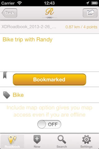
Roadbook management
→ Import any GPX and KML file, from Safari, Mail etc.
→ Displays details such as number of points of interest and distance to go
→ Export roadbooks to GPX format to share with your friends and family
→ Transfer roadbooks via iTunes (import / export)
→ Sort roadbooks by name, distance, tags etc.
Roadbook creation
→ Create a new roadbook directly from your device
→ Simple and intuitive interface
→ Manual mode with positioning of points of interest on the map
→ Automatic mode using the current GPS position (recognition)
→ Add a name, a description and a comment for each point of interest
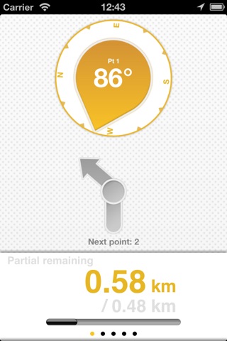
Navigation
→ 3 intuitive modules to follow your path
→ Direction module
→ Direction arrow to reach the next point of interest
→ Compass to keep an eye on the north
→ Display of the course following true north
→ Orientation module
→ Steering arrow to turn to the next point of interest
→ Display information about the current point of interest
→ Display information about the current GPS position
→ Measurements module
→ Display of the distance from the user to the point of interest
→ Display of the partial (distance traveled between 2 points of interest / distance to go)
→ Display of the partial over the entire route
→ Display of the instantaneous speed
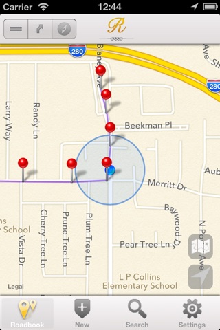
→ Display of the route on a rotatable map (requires an internet connection)
→ Display of the summary of the current route
→ Possibility to easily move from one point of interest to another
→ Intelligent management of the GPS / magnetic compass module
Configuration
→ Displayed units (metric, imperial, nautical)
→ GPS accuracy required
→ Automatic switching distance of points of interest
→ Power saving mode
The app now handles background navigation (you can close the app, navigation still works).
Continuous use of GPS in the background can drastically reduce battery life.